
El Niño

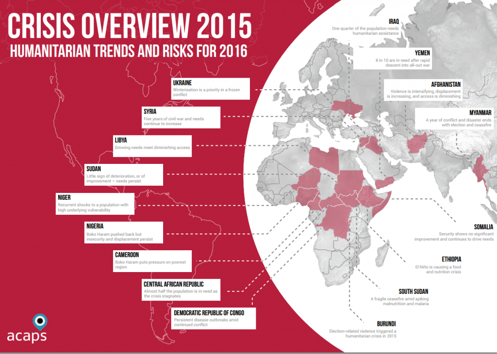
Crisis Overview 2015: Humanitarian Trends and Risks for 2016

In 2012 ACAPS launched the Global Emergency Overview (GEO). Since then, we have provided a weekly global overview of humanitarian crises. The Crisis Overview 2015: Humanitarian Trends and Risks for 2016 is the first attempt to use the three years of data we have gathered for the GEO to identify long-term trends in humanitarian needs and build scenarios […]

Crisis Overview 2015: Humanitarian Trends and Risks for 2016 Read More »

Mapas: Predicciones en Contexto

Nota importante: La Biblioteca de Datos del IRI (IRI Data Library) cerrará próximamente. Para más información, visita: iri.columbia.edu/resources/data-library/sunset Esta colección de mapas, desarrollada por el Instituto Internacional de Investigación del Clima y la Sociedad (IRI) en colaboración con la Federación Internacional de Sociedades de la Cruz Roja y de la Media Luna Roja (FICR), provee

Mapas: Predicciones en Contexto Read More »

IRI Maproom: Forecasts in Context

Important notice: The IRI Data Library will be shutting down soon. For more information, visit: iri.columbia.edu/resources/data-library/sunset This map collection, developed by the International Research Institute for Climate and Society (IRI) in partnership with the International Federation of Red Cross and Red Crescent Societies (IFRC), provides climate and weather information to support humanitarian decision-making and early

IRI Maproom: Forecasts in Context Read More »

Scroll to Top