CoCHAP: Bangladesh
COCHAP Cities in Bangladesh
Both Bagerhat and Satkhira cities in Bangladesh are implementing the coastal hazard resilience component of the COCHAP
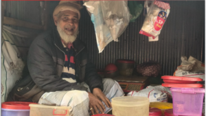
The Bagerhat Municipality is one of the coastal towns of southern Bangladesh of Bagerhat district, which is beside the river Bhairab (Map 1). It was declared asa municipality in 1958 which consists of 9 wards and 31 mahallas. The municipality has a special attraction for archeological heritage with religious norms. The Bagerhat Municipality in the impact zone of Sundarbans, the largest mangrove forest in the world. In Bagerhat Municipality, the total population is 55,086, consisting of 27,325 males and 27,761 females.
 The religious demographics in Bagerhat Paurashava indicate that there are 38,759 Muslims, 10,284 Hindus, 21 Christians, 4 Buddhists, and 5 individuals belonging to other religious affiliations. Additionally, 0.9% of the population in Bagerhat Paurashava are reported to be suffering from various kinds of disabilities. Bagerhat municipality’s economy mainly relies on the service sector, with a substantial portion of the population engaged in service-related occupations. A significant number (62.96%) of males and 23.03% females, are employed in various service industries, reflecting the sector's significance in Bagerhat's employment landscape. Following closely is the industrial sector, which constitutes the second most important sector of employment in the region. A total of 5.98% males and 1.25% females are employed in industrial occupations, highlighting the role of industry in driving economic activity. However, agricultural employment remains relatively low, with only a few individuals involved in agricultural work. Specifically, there are 5.80% males and 0.98% females working in agriculture, indicating the limited contribution of agriculture to Bagerhat Municipality's employment sector.
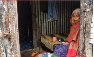
The Satkhira municipality consists of a total population of 138397, of which 50.42% (69780) are male and 49.58% (68617) are female, indicating almost an equal gender distribution in the municipality. The municipality has 1.2% of PWDs of the total population. In terms of religion, the municipality consists of people of four religions, where the highest are followers of the Muslim religion, followed by Hindus then Christians. The people living in Satkhira City mainly have three types of employment opportunities, agricultural opportunity, industrial opportunity, and service opportunity. Of the total employed 20.66% are male and 3.58% female are engaged in the agricultural sector, 6.65% are male and 0.93% female are engaged in the industrial sector and 50.45% are male and 17.72% female are service holders.
Progress and Impact
Bangladesh, (as of August 2024)we completed the following Project activities:
City-Wide Risk Assessment (CWRA)
- City-wide Risk Assessment Reports for Satkhira and Bagerhat municipalities were finalized after incorporating the feedback received from municipality and other stakeholders through the workshops organized. The CWRA process was strengthened and enhanced through two activities that took place in parallel.
- Digital mapping of Bagerhat and Satkhira cities has been continued through updating the existing OpenStreetMap (OSM). The base maps created through this process are used in the CWRA reports.
Enhanced Vulnerability and Capacity Assessments (EVCA)
- Two 2-day refresher training on was organized at Satkhira and Bagerhat for 25 youth volunteers from each municipality. The EVCAs were conducted in all the 9 wards of each municipality. As a result, Risk Reduction Action Plans (RRAP) for each ward are developed and shared with respective wards.
Capacity Building Activities
- A training needs assessment was conducted where around 165 respondents from all the relevant stakeholders of the project participated. Through the assessment, it 4 major topic/theme were identified prioritizing – Disaster Risk Reduction, Climate Change Adaptation, Waste Management and Water Resource Management. Aligning with the training needs assessment, 02 Batches training on Climate Change Adaptation & Urban Development conducted at Bagerhat and Satkhira Municipality with participation from Bagerhat and Satkhira municipality staff and other relevant stakeholders.
Knowledge Exchange Visit to Indonesia
-As a part of the organization’s broader knowledge management efforts on urban resilience, a cross-border knowledge exchange visit was arranged to Indonesia. Prior to the visit, preparatory meetings were held among the American Red Cross Bangladesh Delegation, the Indonesian Delegation, and the national societies of both countries to ensure successful execution. The visit included 14 participants
from Bangladesh, comprising municipality authorities, national society unit representatives, and project staff. The agenda encompassed meetings with PMI NHQ leadership, IFRC Head of Delegation, PMI East Java and Surabaya city, City Government. Additionally, the participants met with the Surabaya city government and visited various sites, including the Surabaya command center, a public service center in a mall, the BMKG office in Surabaya, and an innovative solid waste management site.
During the visit, the Bangladesh team shared the existing interventions of CoCHAP, along with their learnings and challenges. This exchange provided a valuable opportunity for both countries to share knowledge, experiences, and best practices. Learning of this exchange visit has created opportunities to enhance network and linkage between local government of the two countries, national societies and other RCRC partners.
Public Awareness Campaigns and Heat Action Day

- As a part of public awareness campaigns in Satkhira and Bagerhat, Heat Action Day have been observed where life-saving messages have been disseminated. Rally, a
rt competition, water bottle distribution events have also been conducted as a part of the awareness campaign on heat action where school students, community people, WDMC members and Municipality staff participated.
Exploratory Study on Urban Displacement
-An exploratory study on urban displacement has been initiated with the objective of understanding the pattern of urban displacement, analyzing primary reasons, evaluating the i
mpact of displacement on urban areas and the capacity and institutional arrangements of cities to absorb displaced persons, and provide recommendations for stren
gthening city government policies in response to increasing rural-urban displacement due to climate and disaster risks. This study is being conducted by a team led by the Professor and Head of the Environmental Science Discipline at Khulna University, along with academicians from various departments. The team has already submitted the inception report.
Multi-stakeholder Coordination
-To ensure multi-stakeholder coordination mechanism/platform at the city level, project is supportin the municipalities to organize periodic meetings of town level coordination committees (TLCC) and Ward Disaster Management Committee to discuss various issues of the locality regarding the development and resilience building of the cities.
Partnership with Academic Institution
To establish the partnership among Bangladesh Red Crescent Society (BDRCS), International Federation of Red Cross and Red Crescent Societies (IFRC), and Environmental Science Discipline (ESD) of Khulna University, A MoU has been finalized and on the process of approval from IFRC. The partnership will foster the engagement of three parties in research, knowledge sharing & management, and advocacy in Disaster Risk Management (DRM) / Climate Change Adaptation (CCA).
Climate Context
Bangladesh is a low-lying delta region within southeastern Asia with several large rivers systems leading to the Indian Ocean. This makes the country especially vulnerable to extreme coastal and river flooding –particularly as climate change magnifies extreme weather events and sea level rise. Most coastal cities in Bangladesh are less than 1.5 meters above sea level, with approximately 10 % of the country is less than 1 meter above sea level . Bangladesh experiences subtropical monsoon climate with a wide seasonal variation in rainfall. During El Niño periods, Bangladesh typically experiences drier conditions during June to September and during La Niña periods, wetter than usual conditions typically occur.
Average temperature: 26.1°C
Seasonal Variation: 15°C and 34°C, with colder extremes in the mountainous North and the highest extremes around capital city Dhaka.
The warmest temperatures tend to accompany the summer rainy monsoon season from March to September.
Bangladesh is one of the wettest countries in the world with most regions experiencing at least 1.5m of precipitation annually and some receiving upwards of 5.8m. Most of this rainfall is associated with the South Asian Monsoon (June to October)
Tropical cyclone season: November - May.
All coastal cities and adjacent inland areas of Bangladesh are at significant risk of severe flooding and damage of essential infrastructure from tropical cyclone activity. In addition to coastal impacts, tropical cyclones can cause heavy precipitation, landslides, and heavy wind far from the coast (Rahman 2015; World Bank 2021b).
See section 1.2 Climate Change from Climate Center country profile for brief statements. Overall:
- Frequency of hot days and hot nights are projected to increase across the country
- 1.4 and 2.4°C avg temp increase by 2050 and 2100
- The frequency of above-normal floods has increased since 1950s
- Observed shift in rain distribution (since 1960) with increases in March-May rainfall and decreases in June-August rains
- Projected increase in extreme precipitation events
- The frequency and intensity of cyclonic activity in the Bay of Bengal is also likely to increase.
| Climate Policy/Context | Programs/project in climate change adaptation | Useful links (generally climate information) |
| NAPA for Bangladesh 2022
IPCC Policy Brief for Bangladesh Just Transition Policy Brief for Bangladesh
|
Mainstreaming Climate Change into Urban-Related Policies
UNDP Coastal CCA Project on the Southwestern coastal districts of Khulna and Satkhira, Multi-Level Climate Governance in Bangladesh |
Climate Center country profile: Bangladesh
WB Climate Change Knowledge Portal/Bangladesh Municipality specific vulnerabilities USAID Climate Change Fact Sheet: Bangladesh |
Resources
Please check later. We will add reports, case studies, or other resources related to the project's work in the country.