Climate Change Expands the Flooding Map
Climate Change Expands the Flooding Map
Floods are considered the most common natural disaster in the United States. According to EPA ‘United States Environmental protection Agency,’ River Flooding is one of the Climate Change Indicators. This particular indicator examines changes in the size and frequency of inland river flood events in the United States. Climate Change has strongly expanded and shifted the Flooding Map!
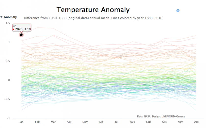
The Earth’s climate is changing. Temperatures are rising, snow and rainfall patterns are shifting, and more extreme climate events – like heavy rainstorms and record high temperatures – are already happening. Many of these observed changes are linked to the rising levels of carbon dioxide and other greenhouse gases in our atmosphere, caused by human activities.
Let’s first define ‘Flooding’. Floodingis a temporary overflow of water onto land that is normally dry. Floods mayResult from rain, snow, coastal storms, storm surges and overflows of dams and other water systems.Flash floods can come with no warning.
As a matter of fact, the risks associated with natural disasters are real, and beyond the imaginations of many of us. Taking into consideration the escalation of the climate change dilemma, both the number of floods and their impact on affected communities are expected to increase dramatically.
Flooding causes outages, transportation disrupt, buildings’ damage and creates landslides.
According to UN Environment Programme, everyone – governments entities at all levels, business, civil society, individuals — need to be prepared to face more extreme weather events as the climate continues to change at an increasing pace. Climate science must be taken into serious account in how we build, adapt and protect our homes, communities, businesses and infrastructure.
Most urgently, greenhouse gas emissions must be reduced, so that rising global temperatures can be controlled while this is still possible. Nature-based climate solutions, such as reforestation and land restoration should be considered, as they can both reduce the impacts of extreme weather events and absorb CO2.
FEMAStates thatifyou live in an area with low or moderate flood risk, you are 5 times more likely to experience flood than a fire in your home over the next 30years. 40% of businesses do not reopen after a flood. Flooding occurs in every U.S. state and territory.
If you live in and around areas that have experienced a wildfire, you face a higher risk of flash flooding and mudflows. Floods are the most frequent type of natural hazard and cause some of the largest economic, social, and humanitarian losses. In the past ten years, floods impacted more than 734 million people. New construction can increase flooding risks if it changes runoff patterns.
(FEMA) provides maps to help homeowners identify their risk: https://msc.fema.gov/portal/search
In conclusion, the statistics displayed here highlight the facts that Catastrophic floods are occurring with greater frequency and growing more costly due to the Climate Change Impact which has seriously affected, shifted, and expanded the flooding Map. Climate change is real. Do your Part and save the environment.
Article Sources: